Fate is taking its toll on the people of the Caribbean: while many islands are just recovering from Hurricane Irma, Hurricane Maria is causing significant damage in its path.
As was the case in previous disasters, the OpenStreetMap community mobilized very quickly to map the disaster areas. The association Télécom Sans Frontieres is deploying satellite connections to reinforce the coordination of relief efforts and to reconnect the disaster-affected populations to the Internet.
OpenstreetMap maps disaster areas
The mapping of disaster areas is crucial after a disaster: it allows to identify and locate the destroyed medical or electrical infrastructures, to identify the routes that allow to bring help to the victims.Within hours of Irma's arrival, Openstreetmap activated the Humanitarian OpenStreetMap Team (HOT). This feature, deployed for every major disaster, allows contributors to update maps, accurately mapping affected areas, blocked or flooded roads, downed power lines, sanitation facilities, places of worship, and food and water supplies. 50 contributors made 300,000 changes to the map, from the southern Caribbean to Florida. The contributors rely on satellite photographs provided by space agencies (as part of the international "Space and Major Disasters" charter), field observations and aerial shots. " We have experience of the earthquake in Haiti: we know that all means are good for conveying humanitarian aid, even bicycles. This implies having an exact knowledge of the smallest piece of road that could be missing and block the relief efforts".
Télécoms sans frontières works to restore communications in the Caribbean
Pre-positioned in Pointe-à-Pitre 24 hours after the passage of Hurricane Irma, Télécoms Sans Frontières (TSF) had obtained on September 10th the authorization to deploy its teams on the islands of Saint-Martin and Saint-Barthélemy. A first internet connection via satellite to the Departmental Operational Center (COD) was established on September 11. On September 15, the Aérogare de l'Espérance airport, used as a logistical platform for the reception and distribution of basic necessities under the supervision of the French forces, had a satellite Internet connection. A second wireless connection was also made available to the civil security and fire departments in order to facilitate emergency operations, reconstruction sites and emergency evacuations.In addition to coordinating relief efforts, TSF is also committed to providing assistance to disaster victims. TSF now extends the Wi-Fi network coverage to areas reserved for families waiting for repatriation or medical care, who can thus reassure their loved ones via social networks and instant messaging.
As the terrestrial network is gradually being restored on Saint-Martin, TSF has decided to mobilize part of its team on site in order to leave for Dominica, devastated by hurricane Maria. Faced with the extent of the damage in Mexico, hit by an earthquake, a team has been deployed in Mexico in emergency.
Telecom sans frontières (TSF)TSF was created in July 1998 by humanitarian workers who had noticed the difficulties of coordinating relief teams in areas where communication networks were often saturated or destroyed. TSF opened its first telecom center in 2001 in the North of Afghanistan, available to all humanitarian actors. TSF's priority is to reach the affected areas and to install connections as quickly as possible, from the first hours of the emergency.TSF's current structure - three operational bases on three continents, in Nicaragua, France and Thailand, as well as a representation in the United States - allows it to intervene anywhere in the world within 24 hours. Since 2006, TSF is the first responder for the United Nations Emergency Telecommunications Cluster.
In nearly 20 years, TSF has intervened in more than 60 countries on five continents and has offered its assistance to hundreds of thousands of victims and to more than 800 NGOs, governments and United Nations agencies. The average duration of a deployment is 47 days, until the telecommunication means are restored, until the UN agencies or humanitarian organizations set up their own telecommunication means or until the management of a telecommunication center is handed over to another organization. Its headquarters are in Pau.
In Syria, Télécoms Sans Frontières is preparing for a sixth year of support to the medical sector for the benefit of the population. The lack of communications in the most devastated areas of the country has led to saturation in the health sector, while the number of wounded and sick continues to grow. Since the start of its engagement in 2012, TSF has deployed 49 emergency connections to hospitals, distribution centers, pharmacies and clinics across the northern half of Syria. As of April 2017, 16 TSF connections are operating in Syria. In 2016, 365,006 wounded and/or sick people received medical support in TSF-connected Syrian hospitals.
TSF has been present in Uganda for several months to respond to a continuous influx of refugees. Numerous facilities have been set up in the border regions of Uganda. Télécoms Sans Frontières deployed a team in July 2017 to respond to the needs of the refugee population. On the ground, TSF works closely with the United Nations High Commissioner for Refugees (UNHCR), local NGOs and refugee families.
Hand provides solar panels and long distance radio beams
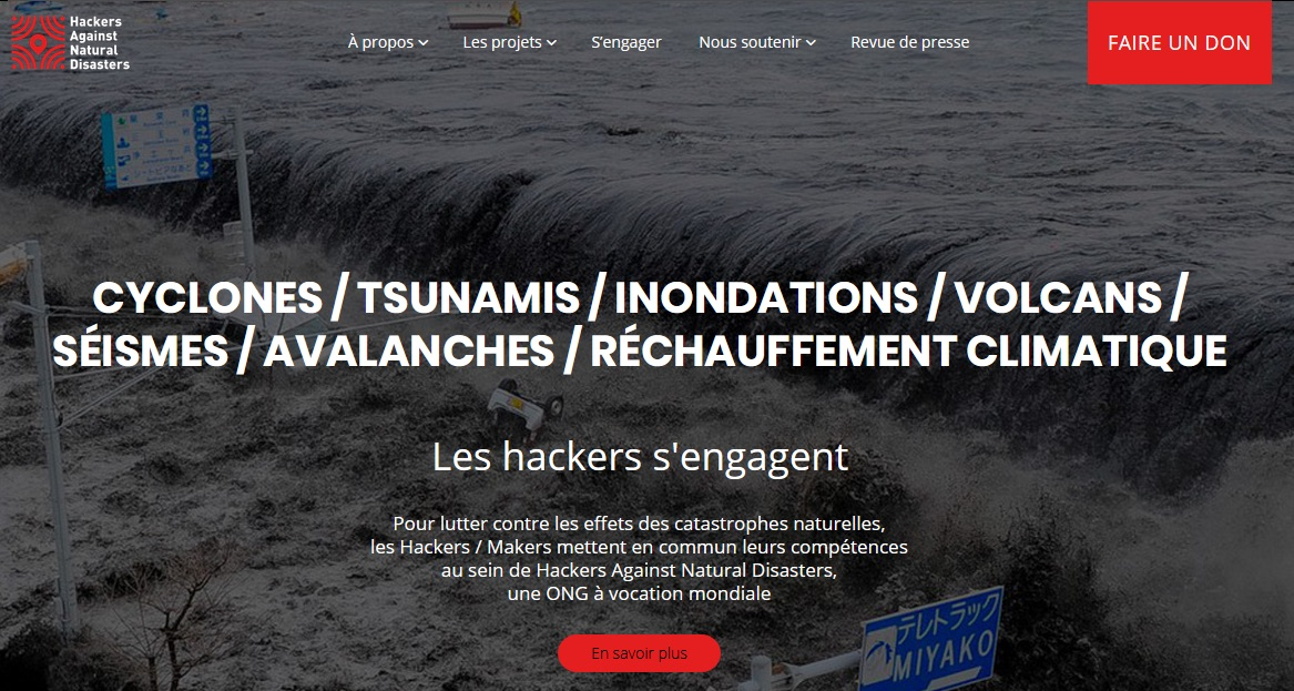
The NGO HAND - Hackers Against Natural Disasters HAND focuses mainly on disaster prevention but also contributes to emergency operations. It quickly got to work from the Fablab to organize a mission on site. On September 15, Hand sent nearly 200 kg of equipment to Guadeloupe, including solar panels, voltage regulators, fuel cells, long-distance radio beams (a few dozen km), WiFi hot spots, etc. "We need basically everything we can get our hands on," says Hand. "We need basically everything that allows us to do without local infrastructure, which is often very damaged and under reconstruction," Gaël Musquet told NextImpact. The material thus brought in then remains permanently on site, in order to maintain the network thus assembled in the event of a new disaster, which is more than likely in these territories. A theory that was unfortunately verified very quickly with the arrival of Hurricane Maria a few days later.Given the extent of the needs and the need to perpetuate its actions, Hand has launched an appeal for donations around three priority objectives
- Emergency: Restore communications on and between the Islands.
- To support the coordination of rescue and civil security forces over time.
- Build a radio network and digital sensors to cope with the crises that will hit the Caribbean in the short, medium and long term. These radio links will be maintained by local radio amateurs and network/system administrators
Hand's objective is to prepare for natural disasters, in order to reduce the number of victims; this preparation is achieved through technological solutions as well as civil exercises with public authorities and populations. Hand made itself known in March 2017 by participating, under the auspices of Unesco, in the "Caribe Wave 2017" exercise: an earthquake and tsunami alert exercise, affecting the entire Caribbean. The scenario involved an earthquake of magnitude 8.7 whose epicenter is located off the coast of Desirade. Such an earthquake would cause a wave of 14 meters that would crash 10 minutes after the tremor on the small island of the archipelago of Guadeloupe and would grow to reach 20 meters high on Pointe-à-Pitre a few minutes later, leaving little time for the inhabitants of the affected areas to take shelter.
According to Gaël Musquet, President of Hand, "in natural disasters, we realize that we always arrive too late, always afterwards". Aware of the fact that natural disasters cannot be avoided, he is nevertheless convinced that we can mitigate their effects by being well prepared. Thanks to a crowdfunding campaign, he was able to set up a multidisciplinary team of geeks to test solutions for responding to natural disasters using digital technology. Beyond the exercise, HAND promotes the use of digital tools in population protection programs, particularly in the event of a major crisis.
VISOV official messages on social networks
The association VISOV (Volontaires internationaux en soutien opérationnel virtuel) had activated on September 6 a team of digital volunteers to relay on social networks the alert bulletins of météo France as well as the official messages communicated by the authorities. It then launched an online form to help identify disaster victims whose news would be sought. Monitoring social networks, in collaboration with OpenStreetMap, VISOV volunteers have created a map for the emergency services, based on information they have found on Twitter, Facebook or in the media.VISOV-International Volunteers in Virtual Operational SupportCrisis monitoring on the Internet can contain extremely valuable and verifiable data on the progress of a disaster, a violent climatic episode or a health crisis. Since 2012, the " International Volunteers in Virtual Operational Support" , doctors, firefighters, computer scientists, developers and radio amateurs, whose founding core is based in Lorraine, have been working on this crisis watch. The first French-speaking virtual community of digital volunteers in the service of civil security, Visov promotes the increased use of "social media in emergency management" (MSGU).
Visov became known during the Ebola crisis: its members had recorded the cases in real time in Guinea by reviewing the media and social networks, organized them and geolocated them on an OpenstreetMap: valuable indications to guide doctors and welcomed by the World Health Organization (WHO).
Visov distinguishes between different levels of activation depending on the severity, nature and time of the event/incident and also the availability of volunteers. On a daily basis, in "active watch" mode, volunteers exchange information in VISOV rooms on the WhatsApp application. Everyone is invited to post sensitive information found on the web that could be of interest to other volunteers or structures present, such as the fire department or the crisis center of the Ministry of the Interior.
Over the past five years, VISOV has been activated more than 30 times, sometimes for several days, during emergency events in France (cyclones, forest fires, attacks, floods, bad weather, floods, high-speed train accidents, etc.) as well as for international events (Hurricane Matthew in Haiti, Cyclone Winston in Fiji, earthquake in Nepal, Typhoon Hagupit in the Philippines, Cyclone Madagascar).
In 2017, Visov was activated 7 times:
- January 5: Eve of an attack exercise in Seine Maritime at the request of the SDIS
- January 12: red alert Storm Egon at the request of the COZ Est and SDIS 7
- February 4: Red alert Storm Leiv
- March 7: Cyclone Madagascar at the request of the COGIC
- July 25-28: forest fires in 5 departments
- September 6-10: Hurricane Irma on Saint-Martin and Saint-Barthélémy (West Indies)
- September 19: Hurricane Maria in Guadeloupe
Hand provides solar panels and long distance radio beams
The NGO HAND - Hackers Against Natural Disasters HAND focuses mainly on disaster prevention but also contributes to emergency operations. It quickly got to work from the Fablab to organize a mission on site. On September 15, Hand sent nearly 200 kg of equipment to Guadeloupe, including solar panels, voltage regulators, fuel cells, long-distance radio beams (a few dozen km), WiFi hot spots, etc. "We need basically everything we can get our hands on," says Hand. "We need basically everything that allows us to do without local infrastructure, which is often very damaged and under reconstruction," Gaël Musquet told NextImpact. The material thus brought in then remains permanently on site, in order to maintain the network thus assembled in the event of a new disaster, which is more than likely in these territories. A theory that was unfortunately verified very quickly with the arrival of Hurricane Maria a few days later.Given the extent of the needs and the need to perpetuate its actions, Hand has launched an appeal for donations around three priority objectives
- Emergency: Restore communications on and between the Islands.
- To support the coordination of rescue and civil security forces over time.
- Build a radio network and digital sensors to cope with the crises that will hit the Caribbean in the short, medium and long term. These radio links will be maintained by local radio amateurs and network/system administrators
During disasters (Haiti, Sri Lanka, Philippines, Pakistan, Chile) and humanitarian crises (Kenya) or health crises (Ebola), we have seen in recent years developers and digital communities (such as the OpenStreetmap community) mobilize, voluntarily and urgently, to map the affected areas or develop software or mobile applications.
A movement called "CrisisCommons" (as well as "Crisis Camps", based on the Barcamp model) has developed during these disasters: it brings together the skills of developers, cartographers and citizens to put them at the service of emergency humanitarian work.
Sometimes disconcerted at first by the arrival of these new players, the United Nations humanitarian agencies (FAO, WHO, UNICEF, UNHCR) and humanitarian NGOs (Red Cross, Doctors Without Borders, Mercy Corps), most often under-equipped in digital skills or used to working with IT service companies, agencies and humanitarian NGOs quickly realized the reactivity and efficiency of these teams and established relationships with them.
These exchanges and cooperations have been formalized through "Crisis Camps" (which allow to establish or complete the cartographic coverage of the affected areas, by locating health facilities, schools or water points), and through hackathons.
In order to capitalize on the expertise built up during these interventions, and to maintain and improve the software and applications, a certain number of these teams and groups have undertaken to structure themselves and even professionalize. Digital humanitarian NGOs have thus emerged to assist in operations, at the request of humanitarian agencies or in coordination with them. Like "traditional" NGOs, they raise funds from companies and citizens.
Some of them are African, like Ushahidi, most of them are Anglo-Saxon:
- International Network of Crisis Mappers (emergency mapping)
- Connected Development-CODE (crisis communication tools),
- Humanitarian OpenStreetMap Team (emergency mapping)
- Disaster Tech Lab (emergency telecommunications)
- Standby Task Force (emergency mapping)
- CrisisCommons (emergency mapping)
- Humanity Road (population support and family reunification)
- PeaceGeeks (organization of hackathons)
- Info4Disasters (emergency operations management)
- Geeks Without Bounds (gas pedal of humanitarian projects, notably through the organization of hackathons)
Références :
Sources
- 1. Usbek&Rica : Hurricane Irma : when data helps save lives
- 2. le Monde : After Irma, Guadeloupeans organize themselves online to help the "northern islands
- 3. NextInpact: Faced with hurricanes, the multiple facets of digital solidarity
- 4. RFI: Hurricane Irma: Télécoms sans frontières to the rescue of the victims
- 5. Usine Nouvelle: How Internet users are mobilizing to help the victims of Hurricane Irma
- 6. Le Monde : After Irma, Internet users mobilized to map the devastated areas
- 7. France Culture: After Irma: the mobilization to restore the networks
- 8. Liberation: Irma: citizen mobilization to restore communication networks