In application of the climate law and resilienceThe Climate and Resilience Act, passed in August 2021, transportation websites and applications (navigation applications, route planners) such as Google Maps, Apple Maps, Waze, Mappy, Citymapper, Moovit or Bonjour RATP are now required to inform users about the pollution generated by their trips and to offer them less polluting routes and alternatives to the car.
These provisions, passed in August 2021 in thearticle 122 of the Climate and Resilience Act, were specified in a decree published in the Journal Officiel on August 5 and completed, the same day, by a decree of the Minister of Transport.
Références :
An estimate of the pollution generated by the journey
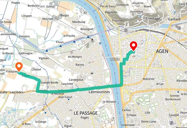
As soon as a user tries to plan a trip, the result will have to show an estimate of the pollution caused, with the quantities of greenhouse gases and air pollutants emitted by the different modes of transport. Multimodal transport applications and sites will have to highlight "route proposals that have the lowest impact in terms of greenhouse gas emissions", the decree states.
Proposed routes to avoid massive traffic transfer to the secondary network
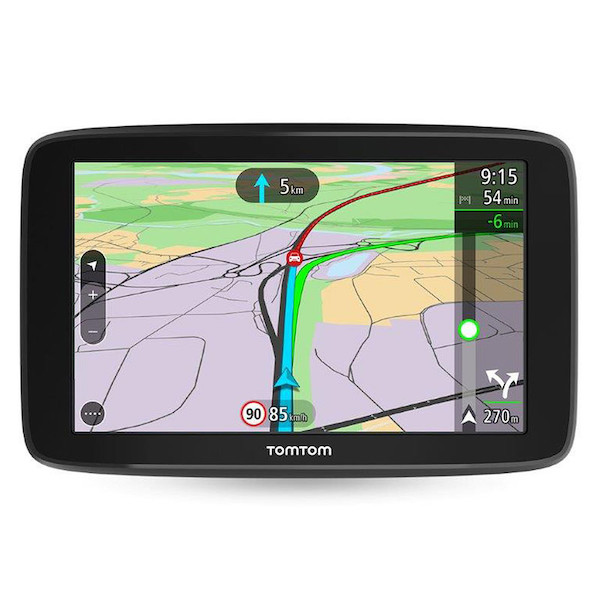
If the trip includes a passage by car on a section where the maximum speed limit is equal to or greater than 110 kilometers per hour (km/h), these applications will have to propose solutions that allow the speed to be lowered by 20 km/h, and thus produce fewer emissions. These services will now have to " try to propose " alternative routes " avoiding the massive use of secondary roads not designed for intensive traffic".
Awareness messages
From December 2022, all websites and applications will have to regularly broadcast awareness messages when a user is planning a trip by car. These messages, such as "For short trips, walk or bike" or " Going from 130 to 110 km/h on the freeway reduces your fuel consumption by 20% " will be accompanied by a signature " #LowerPollutionMovement ".
The applications will also have to inform users of possible traffic restrictions, such as low emission zones (LEZ), which are expected to increase in the coming years.
Encourage modal shift
By the end of 2022, multimodal applications will have to display "data on the bicycle network, carpooling areas and parking" collected in the database of the site transport.data.gouv.frand, by the end of 2023, all public transportation and shared vehicle offers (bicycles, scooters).
Linked articles
7 out of 10 French people use mapping applications
The French are the fourth largest contributors to the OpenStreetMap collaborative map
These communities that rely on Openstreetmap and participatory mapping
A survey on the importance of OpenStreetMap for public actors